40 Years of Advancing The Public's Right To The Waterfront
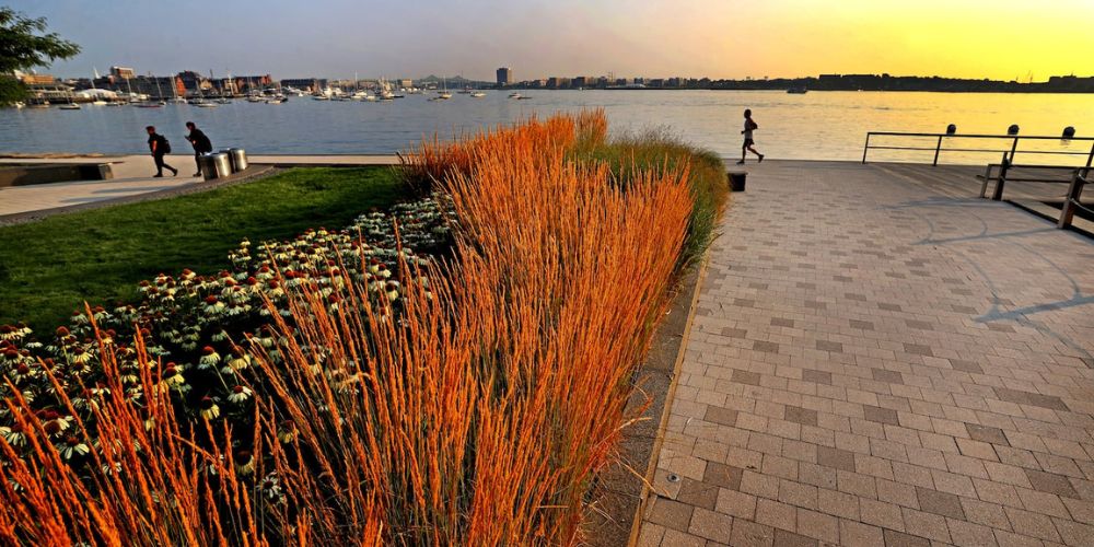
In 1984, the City of Boston embarked on a novel and ambitious plan called HarborPark to ensure the waterfront remained open to the public. From this initiative came the Harborwalk, 43 miles of interconnected parks and public walkways along the water’s edge from Dorchester to East Boston. Today, the Boston Harborwalk boasts hundreds of public amenities including parks, boat launches, public restrooms, observation decks, eateries, and more.
Join us in celebrating the Boston Harborwalk's 40-year milestone through the videos, resources, and guides below!
WATCH: Honoring Vivien Li At The 2024 Onboard Awards
Vivien Li, the former President of The Boston Harbor Association reflects on the 25 years of her work of transforming the city’s waterfront and Harborwalk public access system. At Boston Harbor Now's 2024 Onboard Awards, Vivien was saluted as the visionary who got more of today’s 43 miles of Harborwalk built and opened to the public than any other single figure in its history. Watch the video below!The Harborwalk at 40: A Conversation with Lorraine Downey
Everyone who enjoys and advocates for the Harborwalk is building on the amazing legacy of Lorraine Downey, who served as former environment director for the City of Boston and chair of the Harborpark Plan Commission. At our November Harbor Use Public Forum, Lorraine sat down with our CEO and President Kathy Abbott to tell the story of how her vision of public access to the waterfront became the Harborwalk we know and love today. Watch the video below!Mayor's Proclamation Honoring The Boston Harborwalk's 40th Anniversary
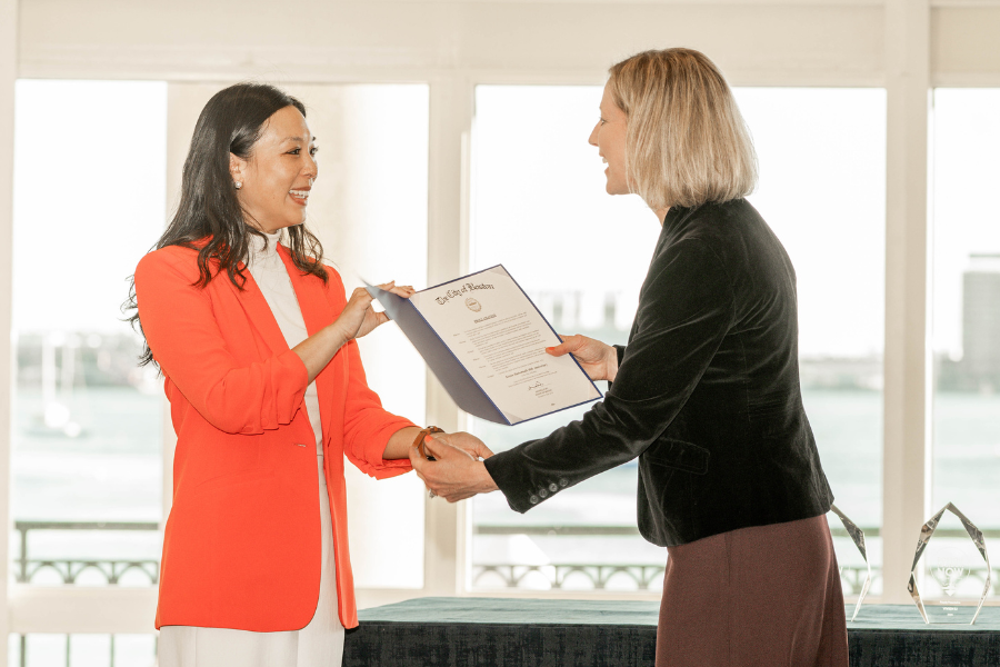 In honor of the 40th anniversary of The Boston Harborwalk, Boston Mayor Michelle Wu issued an official city proclamation, presented to Boston Harbor Now at our 2024 Onboard Awards ceremony.
Op-Ed: Celebrating The Boston Harborwalk At 40
 In this Boston Globe opinion piece, Boston Harbor Now CEO Kathy Abbott and Boston's first Chief Climate Officer Brian Swett reflect on the now 43-mile-long stretch of publicly accessible paths, walkways, and piers along the edge of Boston Harbor and envision the future of our waterfront.
An Online Guide To The Waterfront
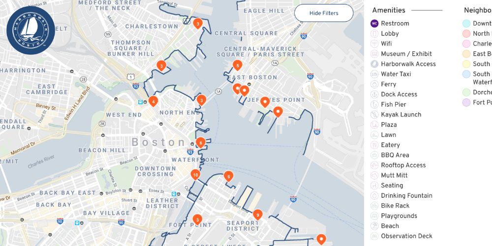 Want to go for a waterfront walk, find the nearest public restroom, or enjoy a rooftop view of the harbor? Use Harborwalk Webtool tool to find what you need along the Boston Harbor shoreline.
Highlighting Often-Overlooked Harborwalk Stories
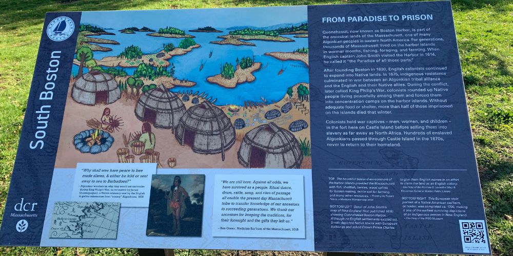 Friends of Boston Harborwalk have added 55 interpretive signs to the Boston Harborwalk in the past six years.
Visit These Harborwalk Spots
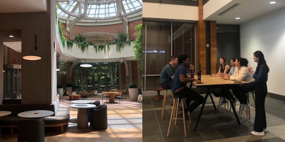 What are FPAs, or Facilities of Public Accommodation? Explore these spots along the Harborwalk that are perfect for remote working, warming up and cooling off, and family fun.
Fort Point Resource Guide
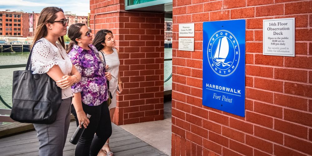 Together with the Fort Point Neighborhood Association, Boston Harbor Now has developed this guide to the opportunities, challenges, desired community amenities, and flood resistance measures that can be woven into redevelopment of the Fort Point Channel.
Visualizing Harborwalk 2.0
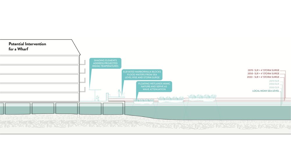 What does the ideal future of an equitable, accessible, and resilient waterfront look like? Boston Harbor Now is pushing for a bolder waterfront vision encapsulated by Harborwalk 2.0. This document highlights best practices we hope to see incorporated along the waterfront.