Boston Harbor Now partners with other agencies, organizations, and academic researchers to lead efforts to understand Boston’s risks from sea level rise and plan for a more resilient future for Boston’s harbor and waterfront.
Stone Living Lab
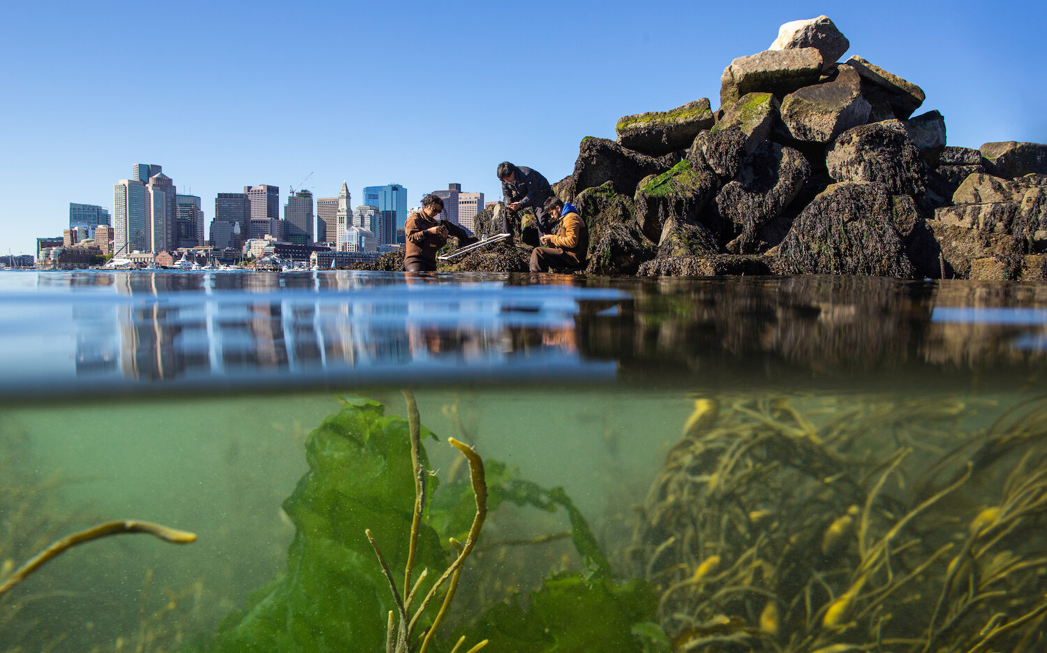
Boston Harbor Now is one of the two anchor partners – along with UMass Boston School for the Environment – in the Stone Living Lab, an innovative and collaborative initiative focused on testing and scaling up nature-based approaches to climate adaptation in Boston Harbor and beyond. It is a unique partnership between government agencies and nonprofits: Boston Harbor Now, UMass Boston School for the Environment, the City of Boston, the Massachusetts Department of Conservation and Recreation, the Massachusetts Executive Office of Energy & Environmental Affairs, and the National Park Service.
Harborwalk 2.0

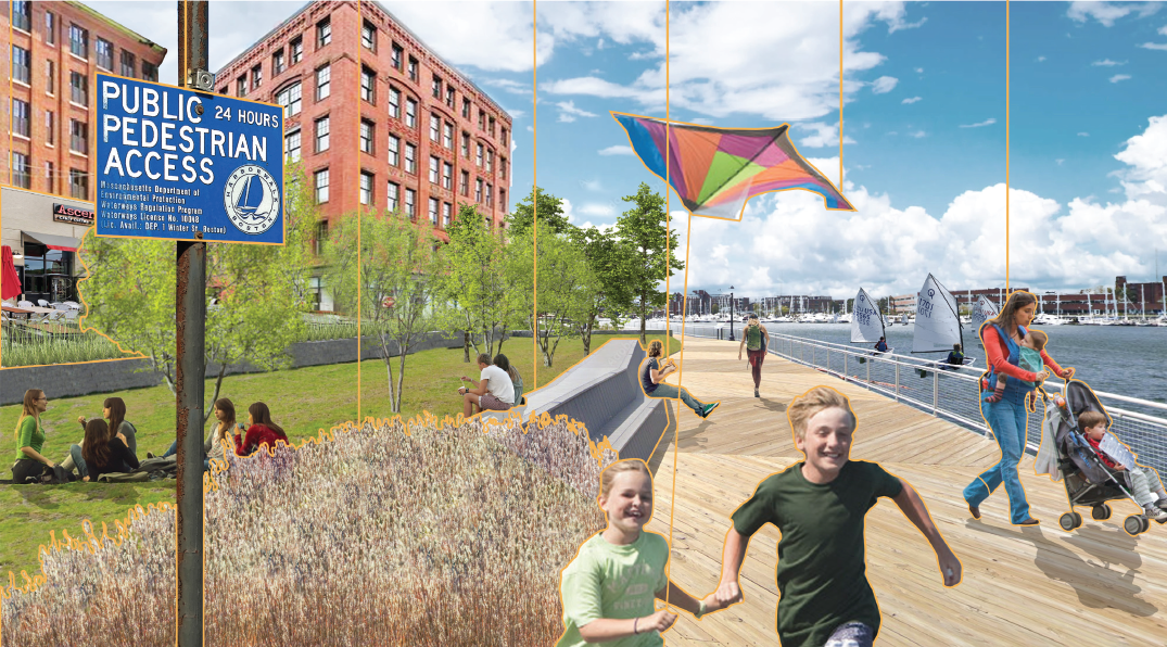
Boston’s waterfront is a publicly accessible resource, thanks in part to the Massachusetts Public Waterfront Act (Chapter 91) along with the tireless efforts of many early advocates who led the charge for the creation of Boston’s Harborwalk, a 43-mile public waterfront walkway. Boston Harbor Now builds upon this legacy and envisions a new and bolder vision for “Harborwalk 2.0”: a fully connected Harborwalk that incorporates climate resilience measures in the face of rising seas. Learn more about the Harborwalk 2.0 vision, read the report, and learn how to get involved at the link below.
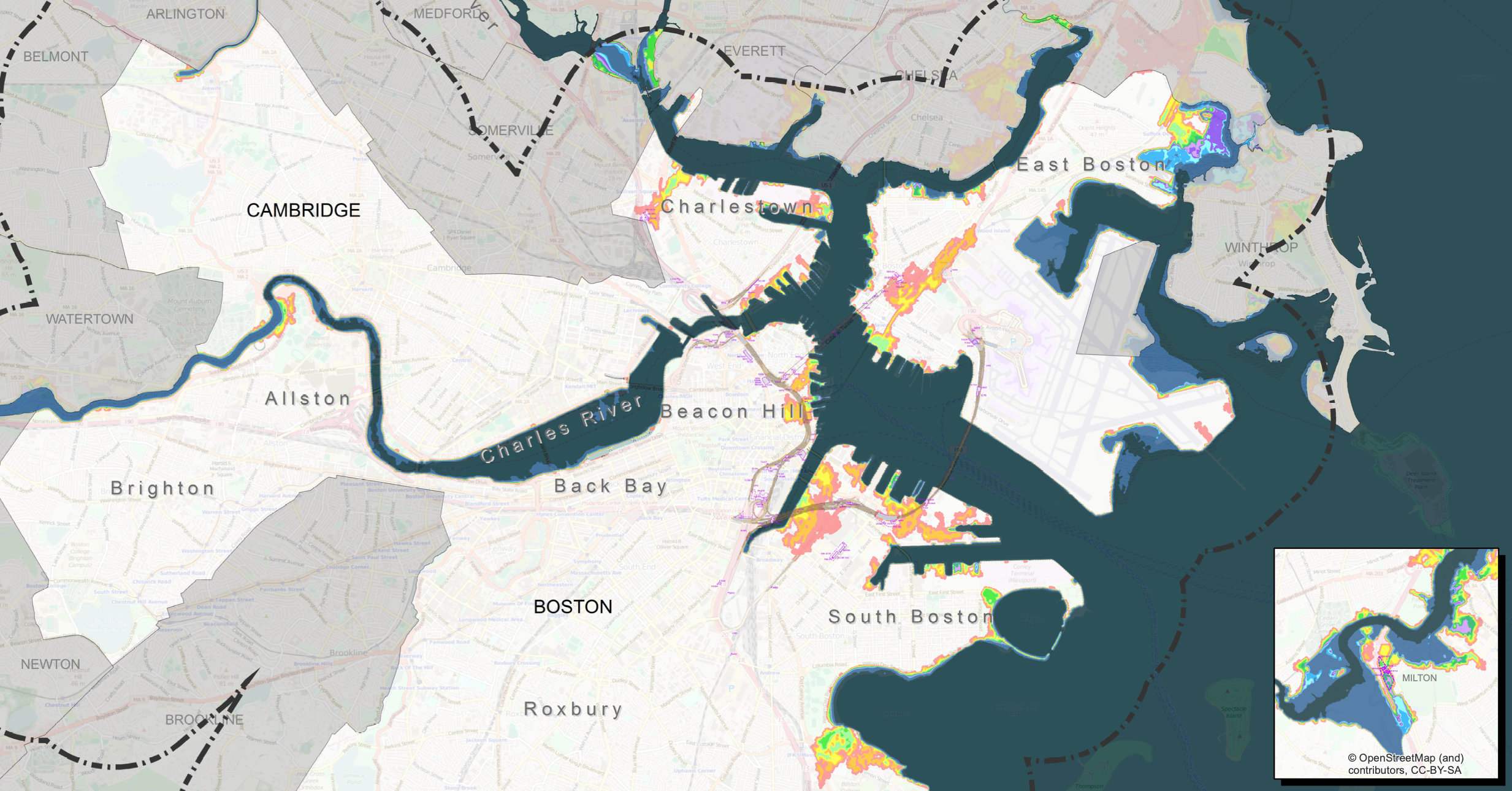
Climate Ready Boston

The City of Boston is taking action to build resilient solutions to ensure that Boston continues to thrive for generations to come. In 2016, the City released the Climate Ready Boston report, which evolved into the ongoing Climate Ready Boston initiative. The Climate Ready Boston team continues to work with the Boston community, public agencies, and private landowners to implement resilience projects that address coastal and inland flooding and rising temperatures. The City’s Climate Ready Boston website features the full 2016 report along with Climate Ready reports for individual Boston neighborhoods.
Resources
Boston Harbor Now, our predecessor The Boston Harbor Association, and agencies and organizations we work with have been involved in numerous studies and publications that evaluate Boston’s climate vulnerability and help plan for a resilient future. These materials along with flood projections for Boston’s coastline are available for download from our website.